Long Track Tornado
Long Track Tornado Hits North Central Kansas

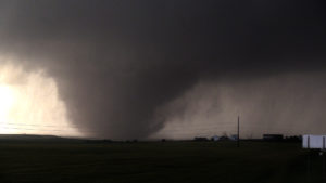
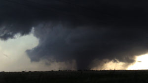
Tornado Tim, storm chaser and author filmed an EF4 Long Track Tornado on Wednesday, May 25th, 2016 as it hit North Central Kansas staying on the ground for over an hour and thirty minutes. Tornado Tim’s video of the first small tornado and the second larger EF4 tornado can be seen at bottom of page.

This is the first tornado we shot before the larger EF4 tornado. As this tornado roped out we drove under it and looked directly into the funnel. Little did we know that this was just the beginning of our chase. I didn’t think at this point the storm would go on to produce the longest lived tornado I ever filmed.
Here is what the NWS report said
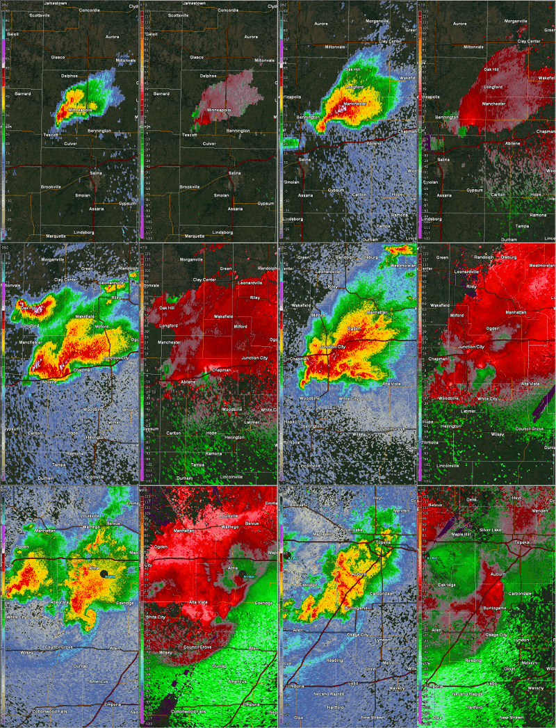
An isolated supercell thunderstorm formed over Ottawa County in north central KS on Wednesday, May 25, 2016, and this storm went on to produce 4 tornadoes. The first tornado touched down at around 6:08 PM 3 miles south of Minneapolis and was on the ground for approximately 1 minute. The second tornado that occurred was a long-track violent EF4 tornado that was on the ground for over an hour and up to a 1/2 mile wide at times. The tornado developed just north of Niles Kansas around 707pm and moved ESE damaging and destroying everything in its path as it passed 2-3 miles north of the city of Abilene. The tornado then appeared to weaken for a time as it moved to the northeast of Abilene however it re-intensified and took a southeast turn as it approached interstate 70 and then went on to produce the most severe damage after crossing interstate 70 just a mile or two southwest of the city of Chapman. The tornado then moved east passing 1 mile south of Chapman and finally dissipated between 835 and 840pm just west of the Dickinson and Geary County line.

Damage summary of Long Tracked Tornado
Following is a summary of the damage survey conducted by the National Weather Service. Tornado – Near Niles, north of Abilene, to just south of Chapman, KS Ottawa & Dickinson Counties
| Date | May 25, 2016 |
| Time (Local) | 7:07 PM to 8:40 PM |
| EF Rating | EF4 |
| Est. Peak Winds | 180 MPH |
| Path Length | 26 miles |
| Max Width | 1/2 mile |
| Injuries/Deaths | 0 serious injuries
0 Fatalities |
| Summary:
This was the second tornado of the evening and the strongest. The tornado moved mainly east across Dickinson county, but as it approached Chapman, turned to the southeast just missing the city. EF4 (violent tornado) damage was noted just southwest of Chapman where a farmstead was completely destroyed. |
|
Radar loops of the long-lived tornadic supercell

This information was obtained from: US Dept of Commerce National Oceanic and Atmospheric Administration and the National Weather Service
