Protection Kansas Tornadoes
Storm Chase Log April 23rd 2007
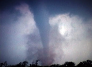
Storm chasing is a very uncertain endeavour. When you start your day in one location, you understand that you will likely have to change locations many times as the day progresses. This particular storm chase was such chase, where we started in Texas, followed storms building up into Oklahoma and ended up catching two tornadoes in Kansas. I had two professional photographers following in their vehicle behind us and it would prove to be their lucky day for tornadoes. Video of these tornadoes is at the bottom of this page.
SPC morning predictions
The day one predictions in the morning looked excellent for catching a tornado.
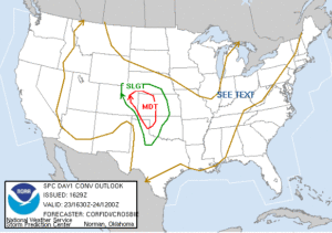
Moderate risks are usually good days for storm chasing, and today would be a day where you could have been in many different locations and still had a chance to encounter nature’s violent rotating column of air, a tornado.
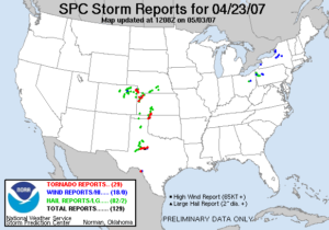
Tornadoes would strike Colorado, Texas, Oklahoma, Kansas and Nebraska, we choose to start in the Texas Panhandle, leaving Amarillo that morning and heading slightly north and east to setup for our beginning target location.
SPC tornado Predictions
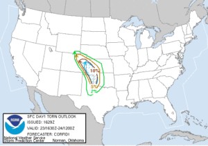
Looking at the tornado prediction map one couldn’t help by salivate at the potential for seeing a tornado, and not just any tornado, but the potential for one that would be on the ground for a while. Looking at a 10% hatched area for tornadoes, with clear skies, plenty of sunshine and moderate dewpoints, getting a good view of these babies seemed probable. And with the wide open spaces we were targeting, it was a dream setup for storm chasing and catching a visible twister.
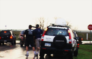
We stopped at first for a while at Canadian Texas, but it wasn’t long before it was clear we were too far west and south. We started seeing some storms firing just over into the Oklahoma border where intercepted them on 283 north heading towards Shattuck, Oklahoma. It was around there that the roads started to get jammed with storm chasers everywhere.
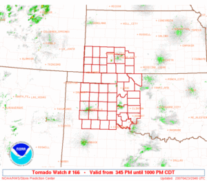
It became more of a caravan of chasers following the building storms moving northeast. We continues to follow the storms that now started to look intense and by the time we got to Buffalo, Oklahoma, it was clear these were going to intensify and produce a tornado in a matter of time. Now it was time to jockey for camera position on the storms where it would be easy to intercept and film any tornadoes it would produce.
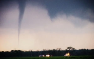
Crossing the border into Kansas we turned on 183 towards protection Kansas, where I sat and watch the now mature storm produce two tornadoes, and almost a third one right next to me.

Tornado time came quickly, with the first one being a small rope tornado that stayed down for a few minutes, followed by the main show of a stronger tornado dancing on the outskirts of Protection Kansas. There were multiple spots where tornadoes could have come down, it wasn’t a single tornado day by any means. These storms were producing multiple tornadoes. At one time I think there might have been 4 tornadoes on the ground in this area at the same time.
